How to draw a Geocentric Universe: (Make your own Heavens' Hinge, Part 2)
This exercise shows how to discover what "the Universe" might have meant for neolithic peoples, particularly in Southern England. It also teaches the concept of solar planes so may be suitable as a curriculum extra.
The exercise:
In this exercise, we'll use observation to draw the Universe as it might have been seen by neolithic peoples. The drawing will end up being identical to Stonehenge. You will need to be at the same latitude as Southern England for this to work. If you're not at a latitude of 51º, you will end up with a slightly different result.
Equipment needed:
a) Two sets of two straight sticks approximately 5 feet long
b) String
c) Two inexpensive wood clamps (not strictly necessary but useful)
d) Approximately 36 beach stones or pegs of various sizes (with at least 6 larger ones)
e) A large hula hoop or some chalk dust
Timing:
a) Preferably done near either near the summer or winter solstice.
b) Make sure you've done exercise one first (or explained where the North Star is and what it is)
c) Session should be of two parts, best done just before midday
The method:
From the earlier experiment, the students will have noticed that the Heavens will revolve around them. We are going to draw that world exactly as the students would see it, and the students will see themselves as standing at the top of a circle (representing the World).
a) Draw a circle to represent the world using a ring of stones (30 is good number for this). Use the string to set it out from a post or marker in the centre). In the experiments, we will be looking from the east so that we can draw the celestial polar axis as we see it. East will represent the top of our drawing.
b) Draw another circle, 3 times bigger, around the first to represent the sky. This could be a large hula hoop or similar. You can't draw the Earth and Sun to scale so we're not going to try.
The North Pole is about 39° anticlockwise from where you are standing. From the Long Man experiment, the students will have checked this. A stick can be used to locate the line of the pole and a couple of stones used to locate it on the ground. (This is why you're drawing looking from the east. If you were drawing it with north at the top, you wouldn't be able to draw the angle of celestial rotation.)
It needs to be mid-day and close to one of the two solar solstices for the next part:
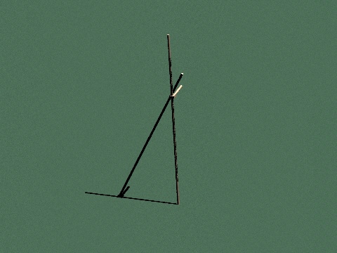
Place one of the sticks so that it points to the Sun (hint: there will be shadow down the slanted stick, but not on the ground, if this is exact). Get another stick, place it upright and lock it to the first using the clamp:
In summer, you will see the sun (at midday) at an angle of about 63° above the horizon. In winter, you will see the sun (at midday) at an angle of about 15° above the horizon.
Take the clamped sticks (summer is shown) and place them on the ground so that the vertical stick is up (east-west) and the other post is at the centre of the circle: The Earth would be a tiny dot at the centre of the circle if it was to scale.
Then place a larger stone on the ground next to the sloping stick:
For a school experiment, you may not be able wait 6 months, so at this point use a pre-made clamped set to show the clamped position of the Sun at noon during the other solstice (the chart at the bottom of this page can be used to get the angle at either solstice). Place another stone near the representation of the circle of the skies:
Now trace lines at right-angles to the polar axis to place midnight winter and midnight summer sun positions using a similar method:
This is your final drawing of the Universe in stone:
And this is how it looks as a drawn diagram:
Your drawing is now exactly the same as Stonehenge's layout:
Post experiment discussion:
The drawing of the Earth is a circle. Stonehenge is arranged as a circle.
The drawing of the celestial axis, a line projected from Earth to the pole star, matches the alignment of Stonehenge's Avenue.
The drawing of the summer solstice solar plane is in the same alignment as two Station Stones at Stonehenge (94 and 91).
The drawing of the sun's position within the solar plane at midnight on summer solstice corresponds with the position of Stonehenge's Station Stone 94.
The drawing of the sun's position within the solar plane at midday on summer solstice corresponds with the position of Stonehenge's Station Stone 91.
The drawing of the winter solstice solar plane is in the same alignment as two other remaining Station Stones at Stonehenge (93 and 92).
The drawing of the sun's position within the solar plane at midnight on winter solstice corresponds with the position of Stonehenge's Station Stone 93.
The drawing of the sun's position within the solar plane at midday on winter solstice corresponds with the position of Stonehenge's Station Stone 92.
Of the Station Stones at Stonehenge, some specific apparent solar events appear to be represented by mounds and ditches surrounding the Station Stones.
A raised circular inwardly facing bank, just beyond the Aubrey circle, exists at Stonehenge in the correct location to correspond to a celestial sphere.
Background:
From the earlier experiment, we saw that the Heavens appear to revolve around us. We have drawn that world exactly as it is seen: The experimenters will have seen themselves as standing at the top of a circle (representing the World).
(If you are looking towards the east, the top of your drawing will be to the east and the bottom will be to the west. If you were to draw yourself, you would be a small dot on the top of the circle. The rest of the universe is described from this 2-D arrangement.)
The celestial polar axis will be a line, 39° anticlockwise, drawn from the North Pole to the North Star.
The equatorial line will be 51° clockwise from where you are standing.
Lines representing solar planes could be drawn at an angle of 51° clockwise.
The solar plane varies, between summer and winter, by about +/-24° due to the obliquity of our planet's orbit. However, on a fixed world, all you can draw is the 24°; you may not know that our planet is spinning. In summer, you will see the sun (at midday) above the horizon at an angle of about 63° (39° + 24°) above the horizon. To draw the summer sun's position at midday, put a point at 27° (90°-63°) clockwise from vertical on a line from the centre of your drawing of the World.
In winter, you will see the sun (at midday) above the horizon at an angle of about 15° above the horizon (39° - 24°). To draw the winter sun's position at midday, put a point at 75° (90°-15°) clockwise from vertical on a line from the centre of your drawing of the World:
The same thing can be done for midnight winter and midnight summer sun positions using a similar method.
Here is an extract from the CIBSE design guide showing the angles of the sun at various times of year: